5 Reasons Drivers Should Vote Yes In The Transit Plebiscite
02 Monday Mar 2015
Posted in Uncategorized
02 Monday Mar 2015
Posted in Uncategorized
17 Tuesday Feb 2015
Posted in Uncategorized
Over the next 10 years Metro Vancouver’s population is expected to increase by 360,000.[1] This analysis examines the impacts and transportation costs associated with this growth. It will consider two different development patterns. The low density pattern has a residential density you would find in a moderate density suburb. The high density pattern has a density equivalent to that of the West End neighborhood in downtown Vancouver.
| LOW DENSITY | HIGH DENSITY | |
| Density (people/km2) | 3,000 | 22,000 |
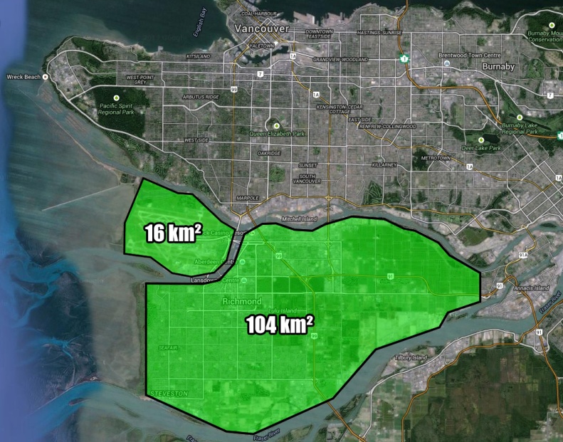
| Undeveloped Area Required | 120 km2 | 16 km2 |

The high density development pattern would occupy the smaller area on Sea Island, while the low density development pattern would occupy all of the highlighted area. We will treat these areas as currently unoccupied.
13 Tuesday Jan 2015
Posted in Uncategorized
In the next 30 years Metro Vancouver is projected to grow by about 1.1 million people.[1] To understand the impact of this growth we will use the West End as an illustration. Pictured below, the West End is a residential area primarily consisting of mid-rise and high-rise apartment buildings. Before the 6-story building cap was lifted in 1957 the West End mostly consisted of detached housing.[2]
Using the population growth projections for Metro Vancouver, we can determine the size of the neighborhoods that would need to transition from single family residential to West End equivalent densities in order to accommodate this growth.
09 Tuesday Dec 2014
Posted in Uncategorized
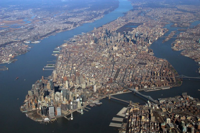
During weekdays the population of Manhattan grows to 3,940,000 people[1]. This population consists of 1,460,000 local residents, 1,610,000 commuting workers, 374,000 local day-trip visitors, 70,000 commuting students, 404,000 out of town visitors, and 17,000 hospital patients[1]. If we add the workers and students with the local day-trip visitors we find that 2,060,000 people need to enter and exit Manhattan around the same times each day.  Currently the majority of these trips are provided by transit, with only 16% of people commuting by personal vehicle[2]. So how would things be different if Manhattan was not served by transit and everybody drove instead? Continue reading
02 Tuesday Dec 2014
Posted in Uncategorized
Burj Khalifa, located in Dubai, is the tallest building in the world. It reaches 830m high and has 310,000m2 (3,300,000 ft2) of floor area.[1] So why have I superimposed it 4 times on the Vancouver skyline? To help illustrate the performance of our rapid transit systems.
02 Thursday Oct 2014
Posted in Uncategorized
02 Thursday Oct 2014
Posted in Uncategorized